

2026-2027 NSGIC Board of Directors Election
Meet Katy!

Biography
Katy Hattenhauer brings over 20 years of public service experience with the State of Arkansas, with a career grounded in geographic information systems (GIS), data stewardship, and public safety initiatives.
She began her career at the Arkansas Department of Environmental Quality, where she served as the GIS Manager and Steward for the National Hydrography Dataset (NHD) and the Watershed Boundary Dataset (WBD). In this role, Katy was able to represent the Southern U.S. on national committees aimed at strengthening the NHD/WBD stewardship program and fostering long-term collaboration.
For the past six years, Katy has served as the Next Generation 9-1-1 Project Manager at the Arkansas GIS Office. In this capacity, she leads strategic efforts to modernize and support critical public safety infrastructure across the state, while continuing to contribute to other GIS initiatives.
Outside of work, Katy enjoys spending time with family and friends, as well as pursuing hobbies like crafting, hiking, kayaking, and sports.
Platform Statement
I’m Katy Hattenhauer from the State of Arkansas. I serve as one of the Arkansas GIS Office’s State GIS Analysts, and in that role I also serve as the project lead for our Next Generation 911 initiative. I have been a member of the National States Geographic Information Council (NSGIC) for three years, and this past year, I was honored to fill a vacancy on the NSGIC Board of Directors. Through that experience, I gained a deeper understanding of the organization, its mission and its goals. I had the privilege of contributing to the strategic plan HUB site, which gave me meaningful insight into the priorities and tasks before us. Equally rewarding was the opportunity to work alongside many exceptional leaders via the Member Resources Committee and the Next Generation 9-1-1 Working Group.
Over my 20 years in state government, I have served in leadership roles which have strengthened my abilities and taught me how to coordinate efforts across state lines in the most efficient and collaborative ways possible. NSGIC is the ideal platform for these efforts to allow GIS professionals to come together through networking and interaction with state members, federal partners, business partners, and other members. This organization allows each state to work together to achieve common goals by learning from each other and growing together.
My focus is on collaboration – bringing voices to the table and ensuring that every state, regardless of its size or challenges, is heard and valued. Each state is unique, but all have something meaningful to contribute. By maintaining strong communication and building lasting relationships within the organization, we can continue to strengthen the foundation laid by current and past leaders and support NSGIC’s mission. Our work matters, and we must remain committed to moving forward together. Together is the only way we all win, and NSGIC provides the tools and resources to make this happen.
If elected, I will focus on building stronger communication and collaboration not only across our internal teams but also with partners outside the organization as efficiently and effectively as possible. Most importantly, I will listen, learn and bring people together to find solutions.
Thank you for this opportunity.
Meet Alfredo!

Biography
Alfredo Herrera is Connecticut’s first Geographic Information Officer (GIO), a position established through Public Act 21 2 and officially assumed on January 3, 2022. A Southwest native, he earned a Bachelor of Science in Urban Planning with a Certificate in GIS from Arizona State University in 2010, and a Master of Science in Aviation Management focusing on imagery-based automated change detection from Embry Riddle Aeronautical University (2016–2020).
After moving to Connecticut, Alfredo built a diverse career starting in IT and facilities management consulting. He served as a GIS Technician at New England GeoSystems (2013–2016) before becoming GIS Analyst/Coordinator for the City of New Haven (2016–2021). During his tenure in New Haven, he embedded GIS practices across municipal departments and earned two Esri Special Achievement in GIS awards.
Selected by Connecticut’s Office of Policy and Management as the state’s inaugural GIO, Alfredo defined the vision and direction for the newly formed GIS Office. Since taking office, he has elevated coordination across state agencies, local governments, regional entities, neighboring states, the federal government, and private industry partners, while advancing key national initiatives including 3DEP, 3DHP, NSDI, and statewide broadband mapping. Elected to the NSGIC Board of Directors for the 2024–2026 term, he actively contributes to advancing geospatial coordination and innovation across the nation.
Notable Accomplishments as GIO:
Strategic Vision: Led the development and adoption of the CT Geospatial Strategic Plan with ongoing annual updates.
Data Programs: Established a statewide imagery and elevation data acquisition program and oversees annual publications of the statewide parcel dataset.
Open Data Access: Launched the CT Geodata Portal, a centralized hub promoting authoritative geospatial datasets and applications statewide.
National & Regional Partnerships: Delivered innovative tools, capacity-building, and outreach while partnering with federal, state, and private entities on national-scale geospatial initiatives.
Alfredo consistently brings a collaborative leadership style that bridges technical and non-technical stakeholders. He regularly mentors peers, speaks at conferences, and leverages his broad background to generate practical and creative solutions for geospatial challenges at all levels.
Platform Statement
NSGIC sits directly at the intersection of complex geospatial challenges and national, state, and local initiatives. Because of this unique position, we must remain deliberate in how we foster collaboration across our entire membership, a commitment that lies at the very core of our mission. Leadership across our officers, board, and staff plays a vital role in ensuring this mission is continuously fulfilled.
During my nearly five years as Connecticut’s GIO and an active NSGIC member, I have benefited immensely from the open, supportive environment this community fosters. The knowledge sharing and camaraderie within NSGIC have directly contributed to my growth and success. Serving on the Board of Directors has deepened my appreciation for our diverse discussions and reinforced my commitment to acting in the best interests of our organization.
If elected President, I will build upon our strategic plan while leaning heavily into NSGIC’s greatest strengths: communication, advocacy, and interagency collaboration. Key priorities for my leadership include:
Strengthening Stakeholder Advocacy: Reinforcing relationships among state leaders, federal partners, and private stakeholders to ensure sustained support for geospatial initiatives.
Scaling Regional Successes: Leveraging the strong regional coordination developed among the New England states in data acquisition, knowledge sharing, and joint advocacy, and exploring models to scale these successes nationally.
Providing Steady, Forward-Looking Governance: Offering steady leadership to help our community navigate emerging technology trends, policy shifts, and operational challenges.
I am deeply grateful for the opportunity to serve this community. If elected, I will dedicate my energy to supporting NSGIC members, advancing national-local coordination, and shaping a strong, collaborative future for our profession. Thank you for your support.
Director Candidates
Meet Paul!
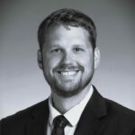
Biography
Paul Dudley is a Location Intelligence Analyst with Tennessee’s STS-GIS Services group, where he supports statewide framework data programs. He serves as Tennessee’s elevation program coordinator, helps manage imagery and recreation data programs, and leads the geodata.tn.gov open data portal implementation. Paul co-founded a state agency GIS coordination council and is a current director of the State’s IT Professionals Association. He is a director and past president of the Tennessee Geographic Information Council (TNGIC) and has chaired or co-chaired its Web and Data Committee since 2020. Paul has received the TNGIC MVP, TNGIC Distinguished Service Award, and University of Tennessee Outstanding Alumni Award. He has been engaged with NSGIC since 2020 and participates in various working groups and committees. He previously worked in the private sector as a lead on large-scale geointelligence data production projects.
Platform Statement
I am honored to be nominated for the NSGIC board. I have thoroughly enjoyed and benefited from this community over the years. I am excited for the opportunity to give back to NSGIC. I have several areas where I think my engagement would help advance the strategic goals and mission of the organization. I have applicable experience as a director on several boards, most notably as President of the Tennessee Geographic Information Council (TNGIC) and a director for the State of Tennessee IT Professionals Association. I have practical experience increasing member engagement and organizational growth. I helped lead a 25% increase in TNGIC’s membership over 4 years and increased engagement through the establishment of a webinar series that has hosted 30+ learning sessions.
I see great value in NSGIC’s mission. I would love to see more states involved and active in the community. I would like to help us increase member engagement and grow our membership by communicating the value of our mission. This supports NSGIC’s strategic priorities, strategic plan for communication, collaboration, and knowledge exchange.
With directive from officers and alignment to the strategic plan, I would focus on the following:
- Support membership growth by demonstrating organizational value through presentations, targeted outreach, success stories, and practical resources.
- Connect adjacent disciplines and business partners with our mission and specifically promote our partnerships with the Federal Geospatial Data Committee, National Geospatial Collaborative, and legislative advocacy.
- Strengthen communication and engagement through my experience with MemberClicks (NSGIC’s member management platform) and web development.
I bring a positive, collaborative perspective, a willingness to listen and understand, and a commitment to helping members participate and see the value of NSGIC. I would appreciate your vote and look forward to the opportunity to serve.
Meet Erin!

Biography
Erin Fashoway is Montana’s GIS Coordinator with more than twenty years of experience in Geographic Information Systems, including two decades of service with the State of Montana. She leads statewide GIS coordination, oversees development of the Montana Spatial Data Infrastructure (MSDI), administers the state’s geospatial grant program, and represents Montana in federal, state, tribal, and local collaboration efforts.
Her professional background spans water and wastewater management, private sector work with Esri, adjunct teaching at Carroll College, serving as the MSDI Administrative Boundaries Theme Lead, and managing the geospatial end of fuel tax assessment for the Department of Transportation. Erin holds a BA in Geography from Bowling Green State University and a master’s degree in City and Regional Planning from The Ohio State University.
Erin has a distinguished record of professional leadership. She currently serves as a Co Chair of NSGIC’s GeoWomen and Western States Caucus. And is the NSGIC Liaison to the National Tribal Geographic Information Support Center (NTGISC). She previously served on the NSGIC Board of Directors (2018–2020) and held multiple leadership roles within the Montana Association of Geographic Information Professionals (MAGIP) from 2008–2011.
She lives in Helena, where she enjoys spending time with her family and exploring Montana’s outdoors.
Platform Statement
I am honored to accept the nomination to the NSGIC Board of Directors. With over two decades of geospatial service and leadership, I am committed to strengthening coordination, partnerships, and the national GIS community.
Since 2016, I have served as Montana’s GIS Coordinator, advancing statewide coordination, enterprise geospatial initiatives, and partnerships across state, federal, and local organizations. My previous board service with NSGIC (2018–2020) and the Montana Association of Geographic Information Professionals (2008–2011) informs my approach to governance, collaboration, and member engagement.
My platform centers on two priorities:
- Sustain NSGIC’s working groups through clearer governance, manageable expectations, and workloads that reflect members’ capacity. These improvements can strengthen continuity, preserve institutional knowledge, and keep key initiatives moving forward.
- Expand national partnerships by building relationships with the National Association of Counties (NACo) and the National League of Cities (NLC) while continuing collaboration with the National Tribal Geographic Information Support Center (NTGISC). These alliances can raise the visibility of geospatial programs and strengthen coordination across sectors.
I would welcome the opportunity to serve NSGIC with transparency, collaboration, and a focus on practical, lasting results.
Meet Katilin!

Biography
Katilin Hughes serves as the Outreach and Education Coordinator for the Missouri Spatial Data Information Service (MSDIS) at the University of Missouri, where she supports Missouri’s statewide geospatial community through data access, education, outreach, and coordination.
Katilin serves as Missouri’s NSGIC State Liaison and is actively involved throughout the NSGIC community. Her involvement includes the Council of Councils, the Member Resource Committee (MRC), and additional efforts focused on strengthening collaboration, engagement, and the future of the geospatial workforce. These opportunities have allowed her not only to represent Missouri well, but also to learn from the challenges, successes, and perspectives of states across the country.
NSGIC has played an important role in shaping Katilin’s career and her understanding of public service. Through the organization, she has developed a passion for bringing people together, asking questions, sharing what states are learning, and making sure the people doing the work have opportunities to learn from one another.
Katilin is also pursuing a PhD in Plant Science and Technology with an emphasis in Digital Agriculture at the University of Missouri. Her research interests build upon her public-sector work and include LiDAR, geospatial data sustainability, precision conservation, and how statewide geospatial infrastructure can better support agriculture and other public needs.
Whether she is working with a state agency, teaching a GIS course, coordinating around a national dataset, or talking with another state about a shared challenge, Katilin believes some of the best geospatial work begins with relationships, and being willing to show up, listen, and make room for others at the table.
Platform Statement
As NSGIC celebrates thirty-five years, I have spent a lot of time thinking about what it took to build this organization and what it will take to sustain it for the next thirty-five.
Our industry is changing rapidly. The technology we use, the data we manage, the needs of our states, and the roles we play as geospatial professionals continue to change. My vision is for NSGIC to grow alongside our industry while holding onto what has made this organization so valuable: its people, relationships, and willingness to work together toward common goals.
I want NSGIC to continue being a place of respite for our community. There are days when it feels like no one quite understands what we do or why the work matters. Then there are the mountaintop victories when a project comes together, a partnership works, or we finally make progress on something we have been working toward for years. NSGIC gives us a place for all of it, surrounded by people who understand. That community also gives us the opportunity to accomplish more together by sharing what we are learning, connecting with states facing similar challenges, bringing new ideas back home, and working toward the common goals, data initiatives, and priorities that move our geospatial community forward.
Looking toward the future also means investing in the people who will carry this organization forward. I am early in my career, and I bring curiosity, energy, new ideas, and a willingness to learn from those who built the programs, partnerships, and community we rely on today. I know firsthand how much it matters when someone invests in you, challenges you, and gives you an opportunity to contribute. NSGIC did that for me before I fully understood what I could bring to the table, and those experiences have shaped the public servant and geospatial professional I am today.
If elected to the Board, I will help NSGIC build upon that foundation while preparing for what comes next. I want to listen to our members, ask questions, connect with people and ideas, and bring my experiences serving Missouri into strategic conversations. I want us to continue strengthening relationships between states, developing our shared goals and initiatives, investing in future leaders, and asking what NSGIC needs to be as our industry continues to change.
Thirty-five years of people showing up, sharing ideas, building relationships, and believing in the value of this community created the NSGIC we have today. My vision is to honor what they built while helping ensure NSGIC remains a place our community turns to for support, collaboration, new ideas, and people who understand. Serving on the Board would give me the opportunity to help build that future so those who come after us have the same opportunity to find their place within this community and know there is a seat at the table for them.
Meet Matt!

Biography
Matt was born and raised in eastern North Carolina and lives three minutes from his childhood home. Two minutes if the tractors aren’t running. He began his career as a Marketing Technician at Geographic Technologies Group (GTG) while earning a Bachelor of Science in Computer Information Systems from the University of Mount Olive (formerly Mount Olive College). At GTG, Matt latched onto the tech we all know and love, GIS, and went on to complete his Master of Geospatial Information Science and Technology at NC State University in 2014.
The call to public service came in 2019. Matt left his role as Chief Technology Officer at GTG to become Assistant Director of North Carolina’s Center for Geographic Information and Analysis (CGIA), under the care and tutelage of none other than Tim Johnson. One of his first assignments was serving as the Next Generation 9-1-1 GIS Project Manager, quickly followed by leading CGIA’s cloud migration. In 2025, Matt was named North Carolina’s GIO and Executive Director of CGIA, where he serves today. In 2026, he graduated with Leadership North Carolina’s Class 33, a program that brings together public and private sector leaders committed to driving improvements across the state.
When he’s not clocked in, Matt enjoys time with his wife and two daughters, serving on his church’s tech team, and dabbling in videography, photography, and drones. He also serves as an elected official, chairing the Southern Wayne Sanitary District Board.
Platform Statement
Hey y’all! Yes, I used “y’all” in my platform statement. You’ll often find me in a jacket and button-up, but some of my favorite conversations happen in more relaxed settings. Sometimes the best ideas and solutions show up outside the office, and that’s okay.
I started my GIS career in the private sector in marketing, sales, and GIS strategic planning, then moved into technical roles that led me to public service. Prior to serving as North Carolina’s GIO, I held the Assistant Director role which afforded me the opportunity to contribute to technical projects alongside our services team. This career path not only sharpened my technical skills but has developed me into the leader that I am today. I hope to bring a perspective that’s packaged for leadership, but deep enough for the technical folks to dig into.
Collaboration may very well be the buzzword of 2026, but it matters. Relationships matter, and they don’t form or survive without collaboration. States succeed when local governments succeed. We don’t have successful NG911 programs or an NSDI without them, at least not without a lot more effort. As we push for continued support of the NSDI, the NAD, a national parcel dataset, and more, we need those relationships and need to understand how they’re built and strengthened. I bring that experience to the Board and expect it to translate across all levels of government and across state lines. Okay, maybe AI is the buzzword for 2026, but that ruins my lead-in. I digress. Whether it’s NG911, moving to the cloud, or just sharing more about North Carolina’s experience, I’m happy to hang up the jacket and roll up my sleeves.
I’m honored to be nominated. In 2027, NSGIC enters the final year of its current strategic plan, which means this Board will help shape the next one. I’d be grateful for your vote and would be excited to serve alongside great leaders as we shepherd NSGIC into its next chapter.